THE RIBBON PEDESTRIAN SKYLINE
The freeway, an iconic yet polarizing feature of Los Angeles' urban landscape, stands as a monument to the city’s sprawling infrastructural identity. While it has undeniably shaped the city’s mobility and connectivity, its enduring negative impacts on the social and cultural fabric of L.A. cannot be overlooked. In response to the challenges posed by the freeway system, we were tasked with selecting a specific sector in Los Angeles and designing a 15-minute walkable city to address these issues. The project was structured into two distinct phases: the concept design phase, where we conducted a thorough analysis of the key problems associated with the freeway system, and the sector development phase, during which we synthesized our findings into a comprehensive infrastructure plan. This plan aims to mitigate the detrimental effects of the freeway, fostering a more cohesive, equitable, and sustainable urban environment.
01 SUPER FUTURE - AUTOPIA CONCEPT DESIGN
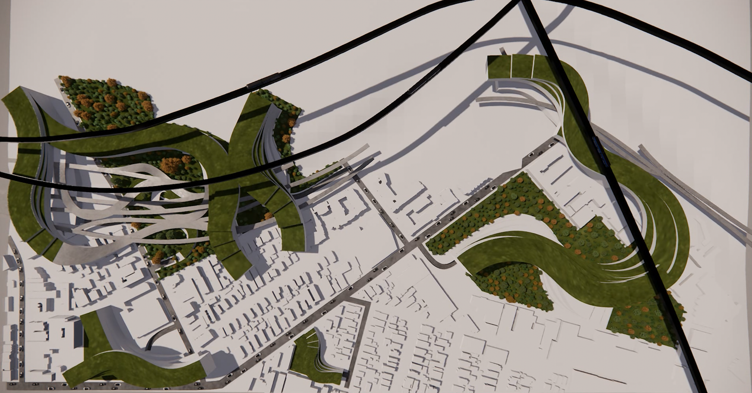
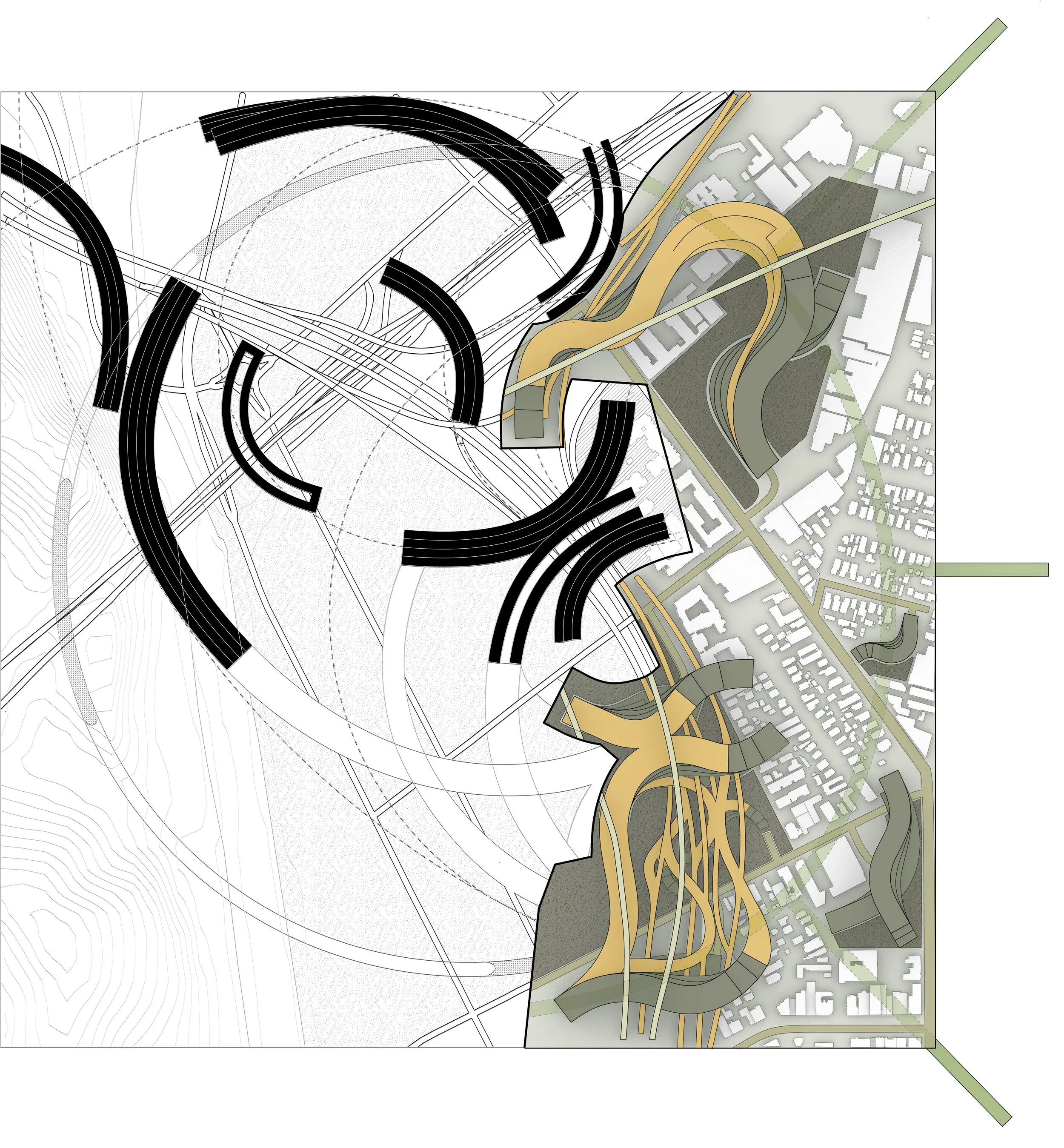
OVERALL PLAN
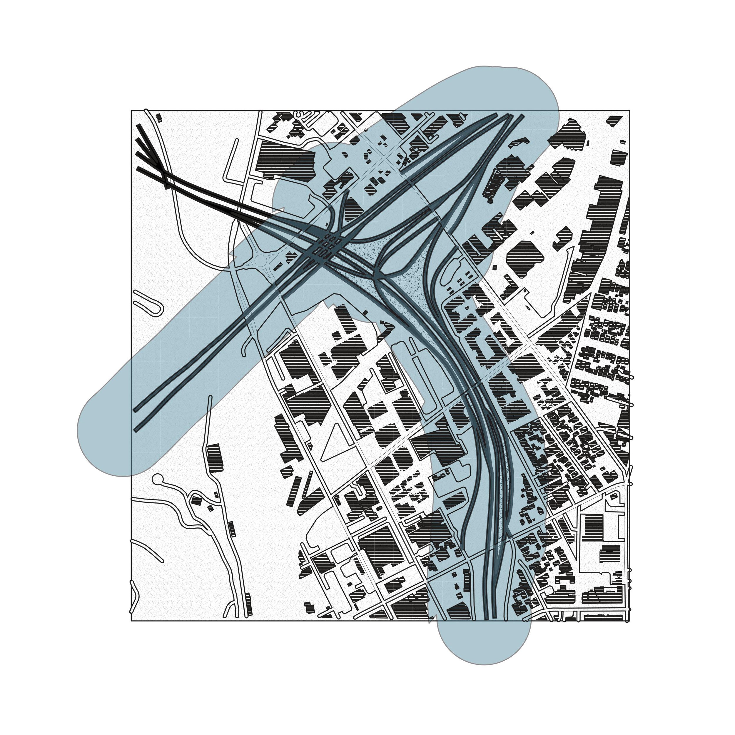
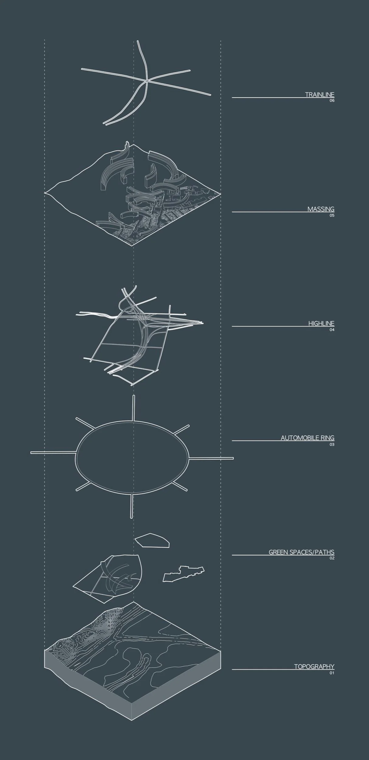
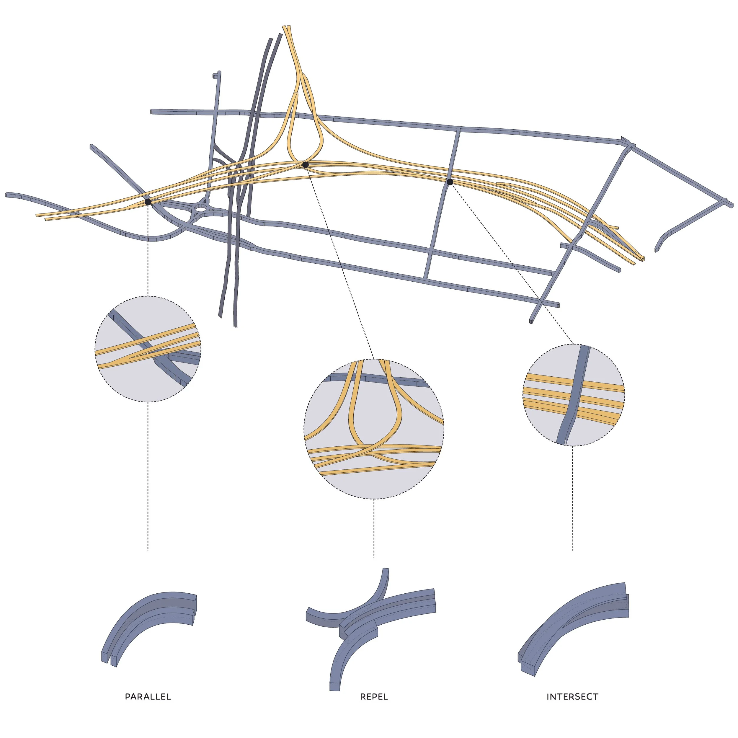
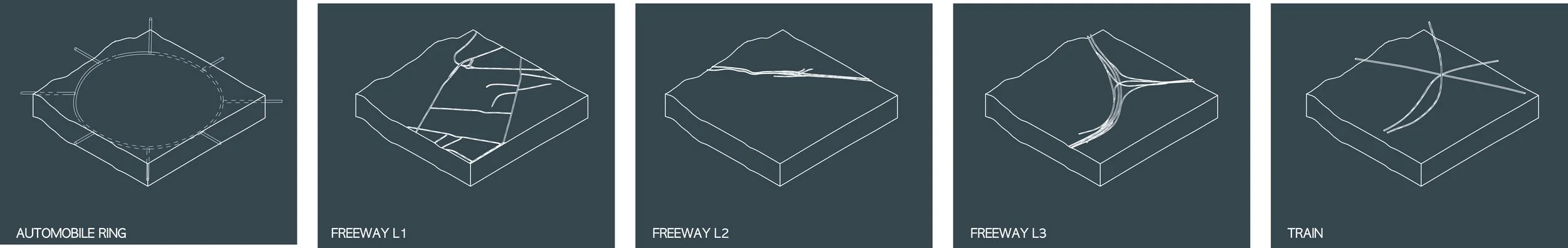
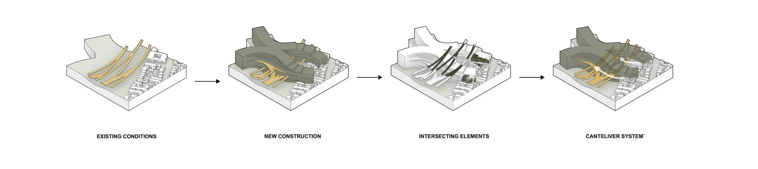
The freeway is a monument integral to L.A.’s cityscape. While its significance in the city’s infrastructural fabric is undeniable, its detrimental effects on the social and cultural fabric of L.A. linger. The freeway tears through predominantly communities of color, as well as those of lower socioeconomic classes. As a response, we created layers of systems that target each of the following issues: division, pollution, walkability, and unoccupied spaces. The first system we created was a ring freeway system around the square mile, as a response to mediate the division and unused spaces with traditional freeway systems. These are units of a larger system and are adaptive to conditions where they burrow underground or protrude up. The second system we created was the ribbon massing structures that are also adaptive to their surroundings. They interact with their existing environment and structures by intersecting, passing over, or burrowing into the ground. They are also monumental land bridges that connect different spaces where the old freeway is divided. The third system was the reclamation of the freeway system—the freeway was a sparsely populated structure that held people temporarily. We want to densify the freeways and make them usable. Therefore, we excavated part of the freeways and vegetated them creating exclusively pedestrian and bike paths all throughout the old freeway system to tackle these issues.
PROBLEM ANALYSIS
PROBLEM ANALYSIS
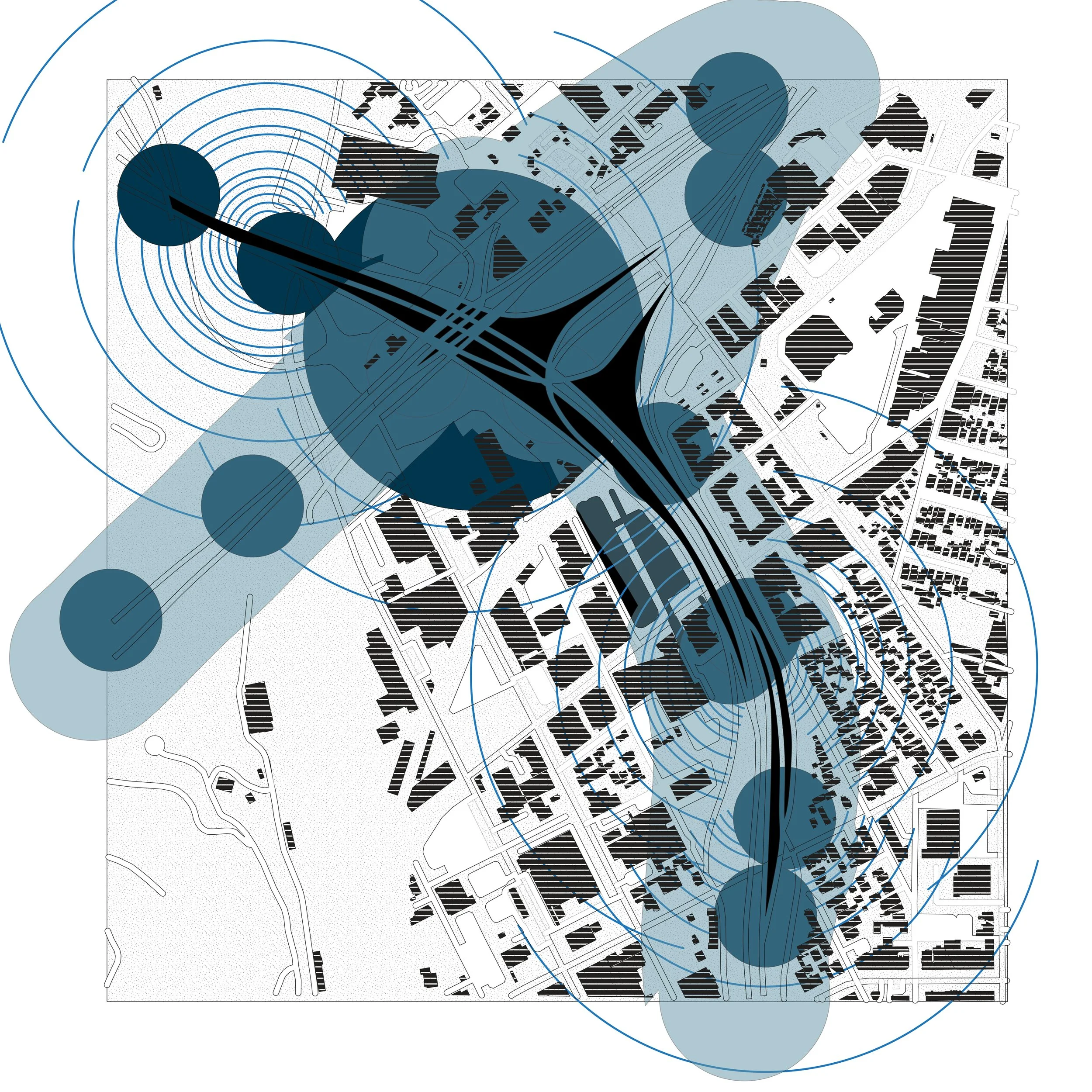
HEALTH RISK ZONE - 500’ RADIUS

NOISE POLLUTION ANALYSIS
SMOG ANALYSIS
CONCEPT DIAGRAM
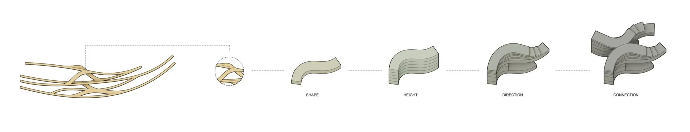
An ode to the monumentality of the freeway system as a history of L.A.’s past. These ribbon buildings adapt and conform to the curvature of the existing freeway system, as well as the L.A. River. The radii and curvilinearity adapt to the surrounding condition that it sits on, passes over, or intersects. to create dynamic and vibrant pedestrian paths that extend beyond mere utility, offering an engaging and entertaining experience for those utilizing the transport infrastructure. In doing so, the project aims to promote pedestrian transportation, reduce reliance on automobiles, and cultivate an intriguing and enjoyable environment for its inhabitants.
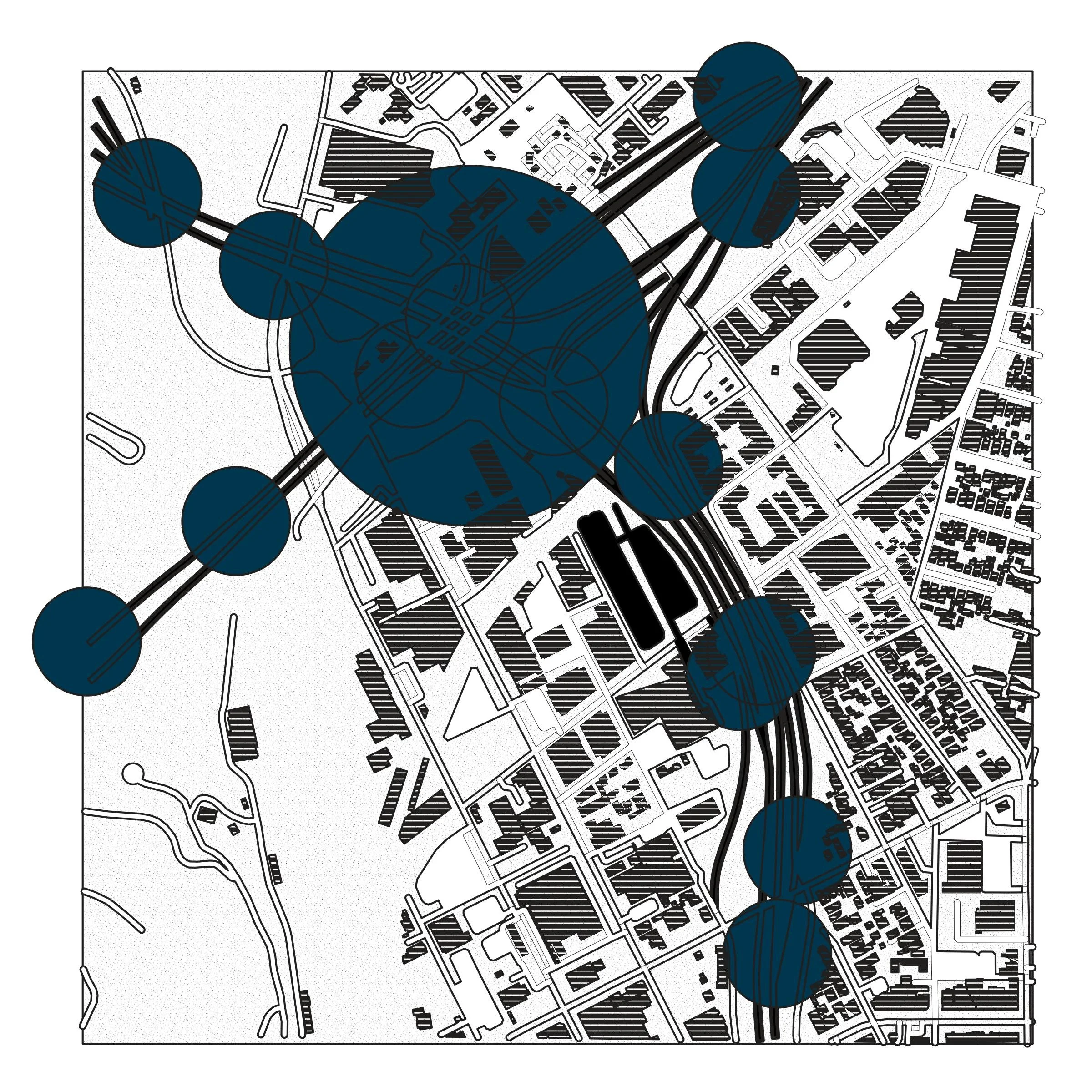
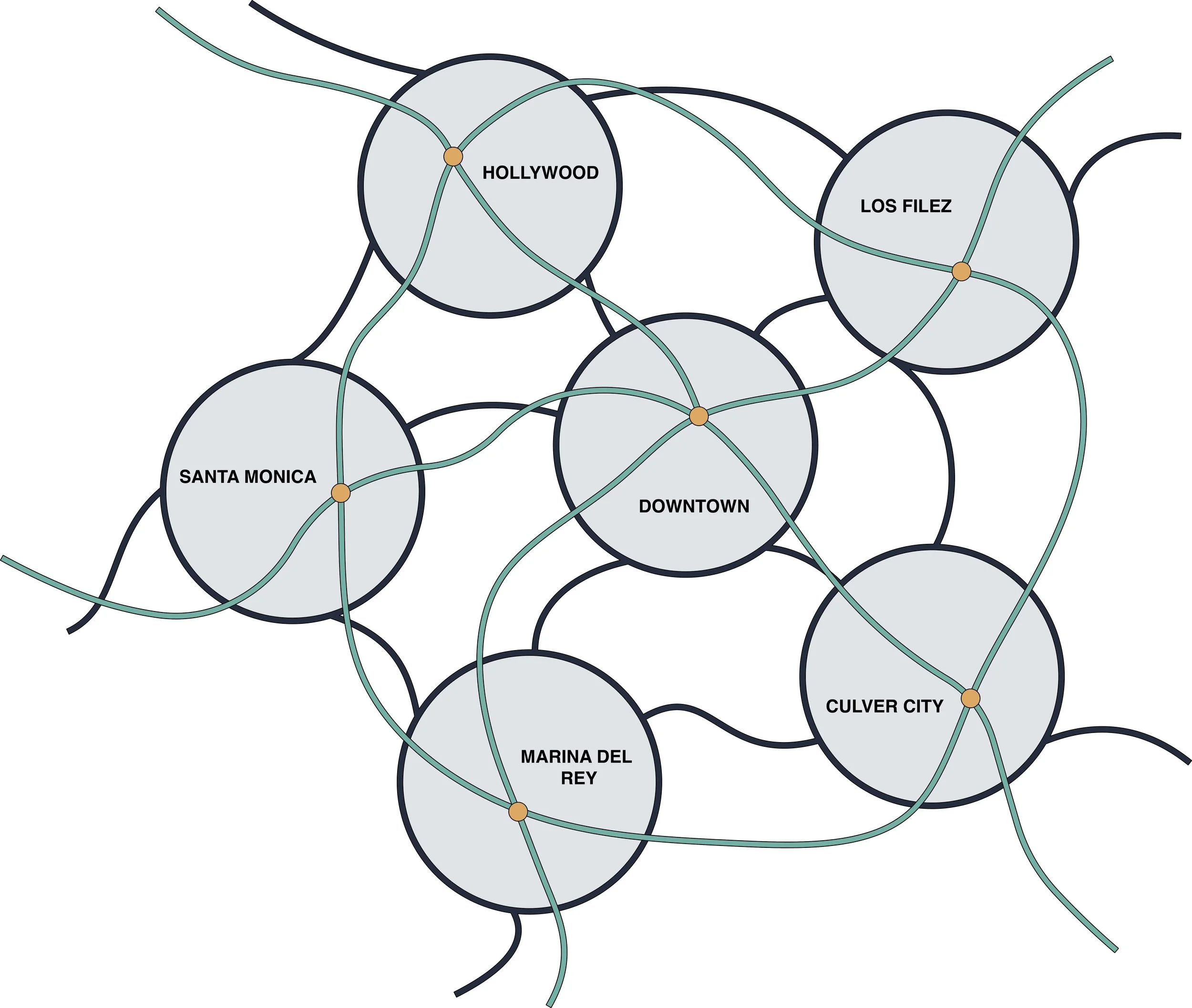
CONNECTIVITY
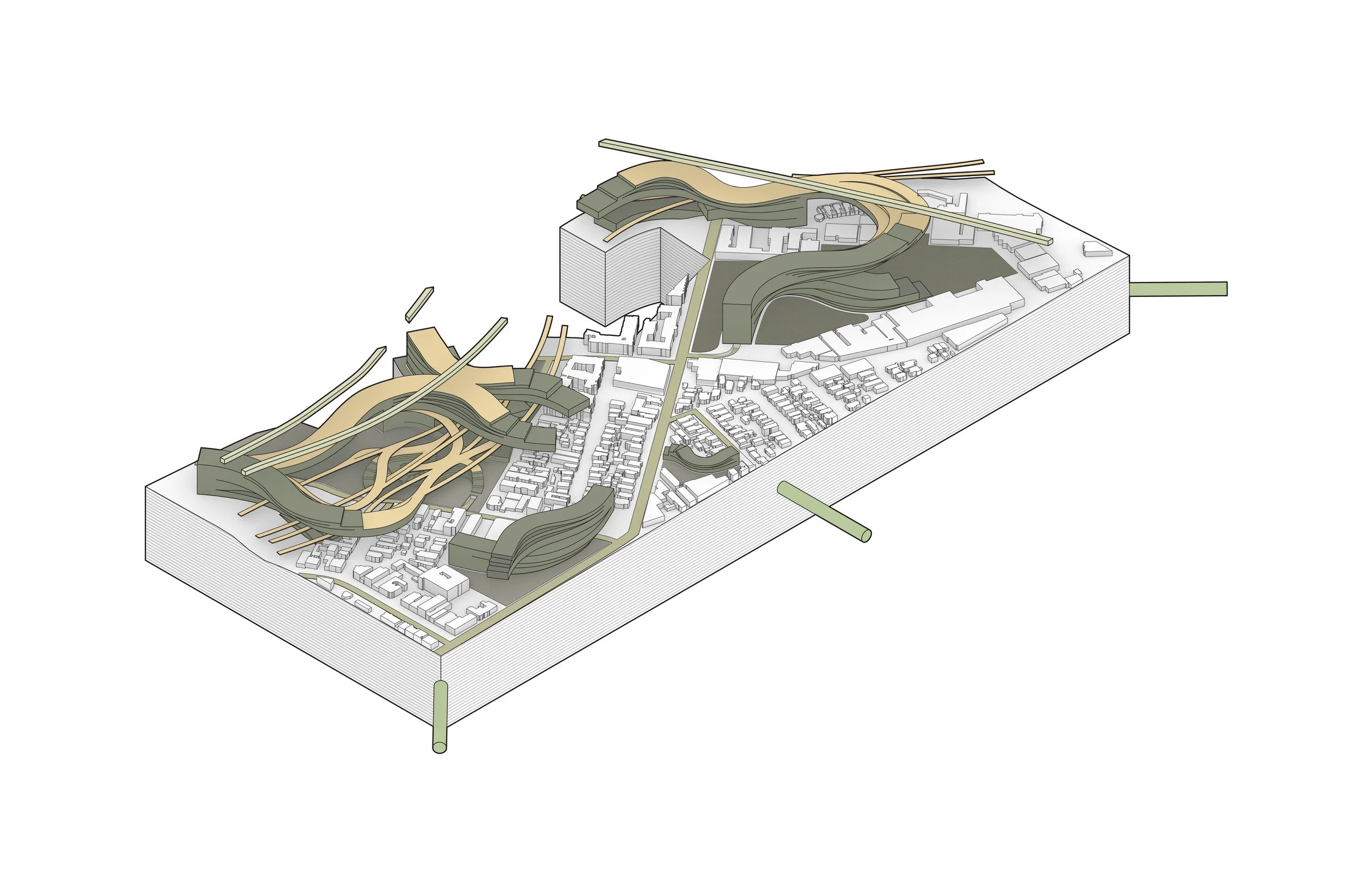
With the addition of a ring loop network that encircles the square mile footage, it holds most of the automobile traffic and connects various points within the circle while reducing car traffic usage. Furthermore, the addition of the massings is not only for residential and commercial usage. They are also land bridges—they pass over, intersect, and sit on existing conditions. Where the freeway used to divide, now it is readily accessible.

ON A LARGER SCALE...
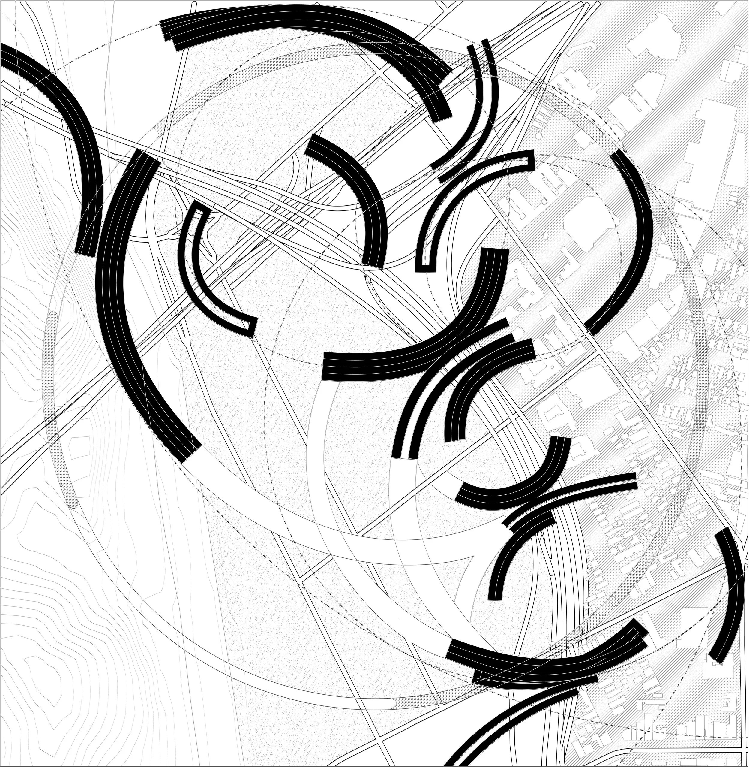
We created the ring system as a modular unit. The freeway system cut through not only the urban fabric but also the social fabric of Los Angeles. Within the circular system, we can avoid cutting through neighborhoods and creating a divide. The ring is equipped with a series of exit points and spokes connecting to other circular networks. In a way, this is kind of similar to the old freeway system, however, they do not create unoccupied spaces or divided spaces.


RADII ANALYSIS
The radii analysis is part of the conceptual being of our massing. Not only do these ribbon structures intersect with the surrounding conditions, but, they also harmonize and form geometric relationships with one another. They are bounded within two large radii—the largest being a fourth of a circle. Where the freeway system became the densest, so did the intersection of the radii. The hatches reflect the densities of the massings which in term refers to the density of the square mile footage.
DIAGRAMMATIC MODEL PICTURES


02 SECTOR DESIGN - THE RIBBON PEDESTRIAN SKYLINE
Part III of our design process consisted of taking our overall concept and selecting a specific section to further design and develop. I chose to focus on the design of the freeway system that we converted into our pedestrian skyline and how this infrastructure would be seamlessly integrated into the surrounding urban context. The main goals I hoped to achieve with this design included:
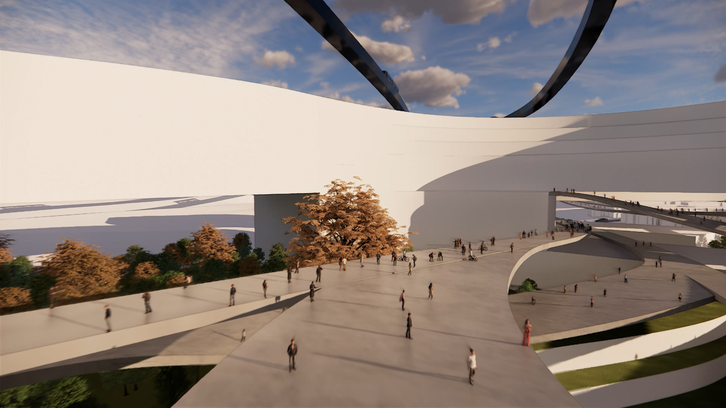
Building - Bridge Integration: Creating a network of pedestrian paths that blur the lines between when the walkways end and where the buildings begin.
LA Freeway Design Inspiration: Using the existing LA freeway system as a foundation from which I developed the design for both the pedestrian paths and the buildings themselves.
Lively Experience for the User: Designing an infrastructure that would promote pedestrian transportation over that of vehicular transportation, ultimately addressing the larger issues posed by the automobile culture of Los Angeles.
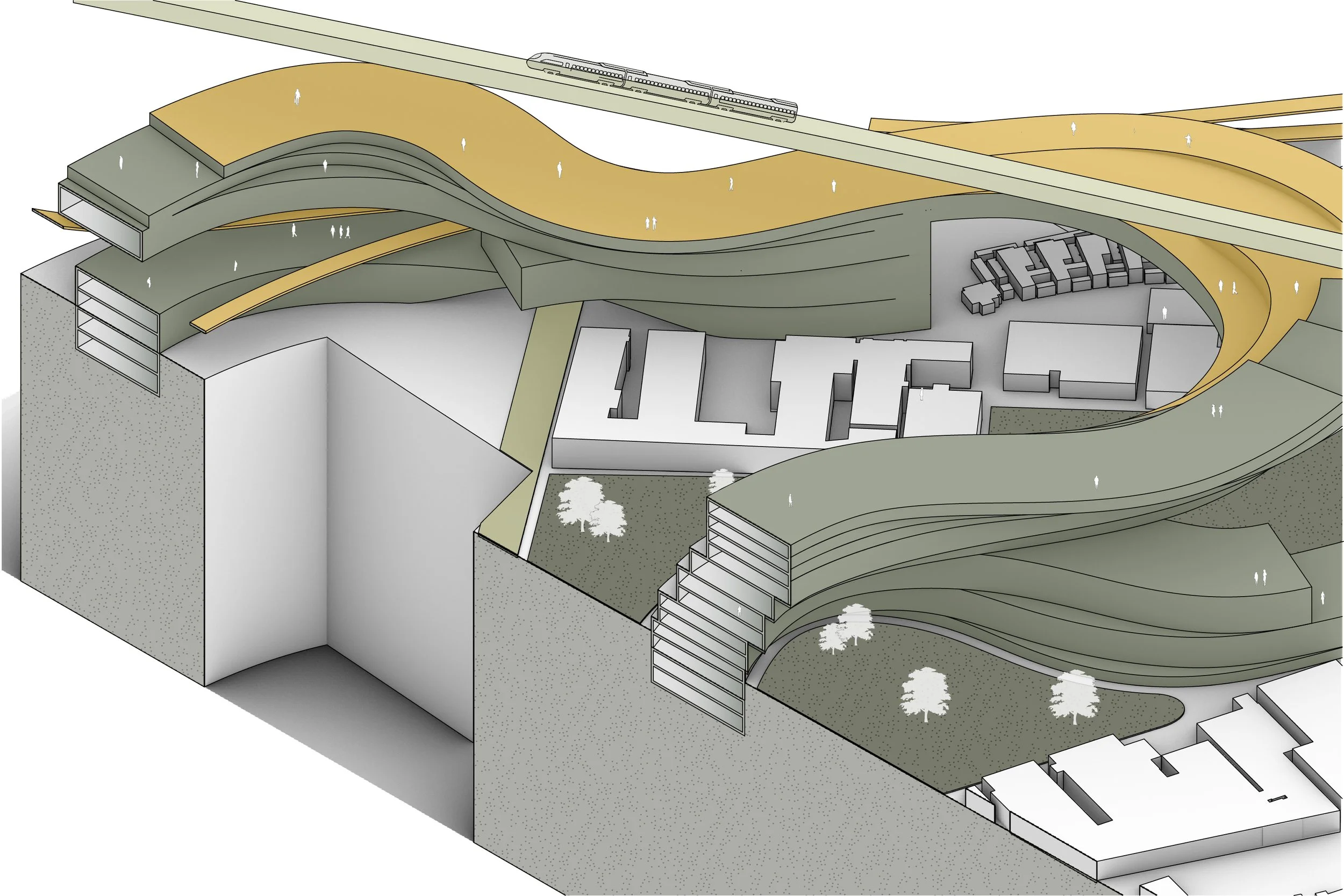
MASTER PLAN
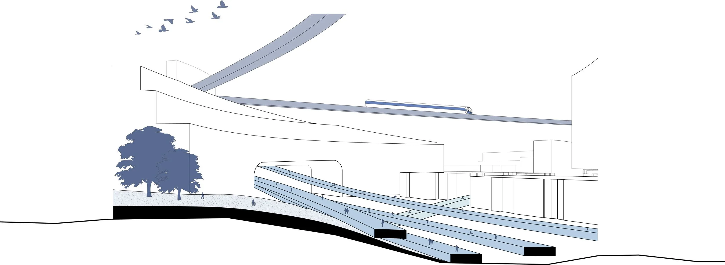
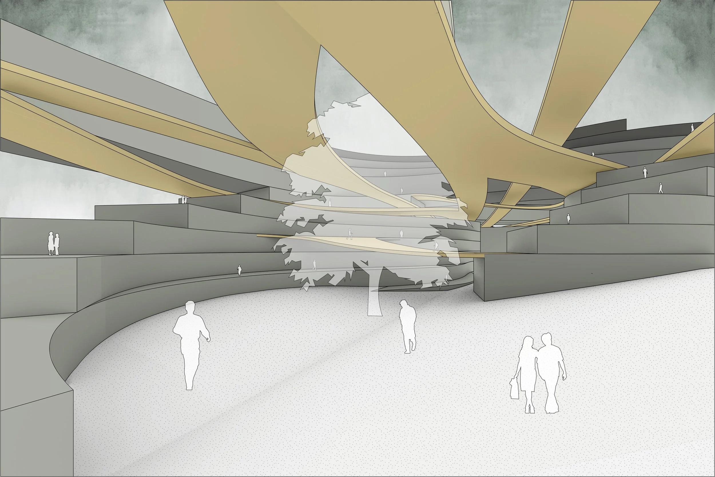
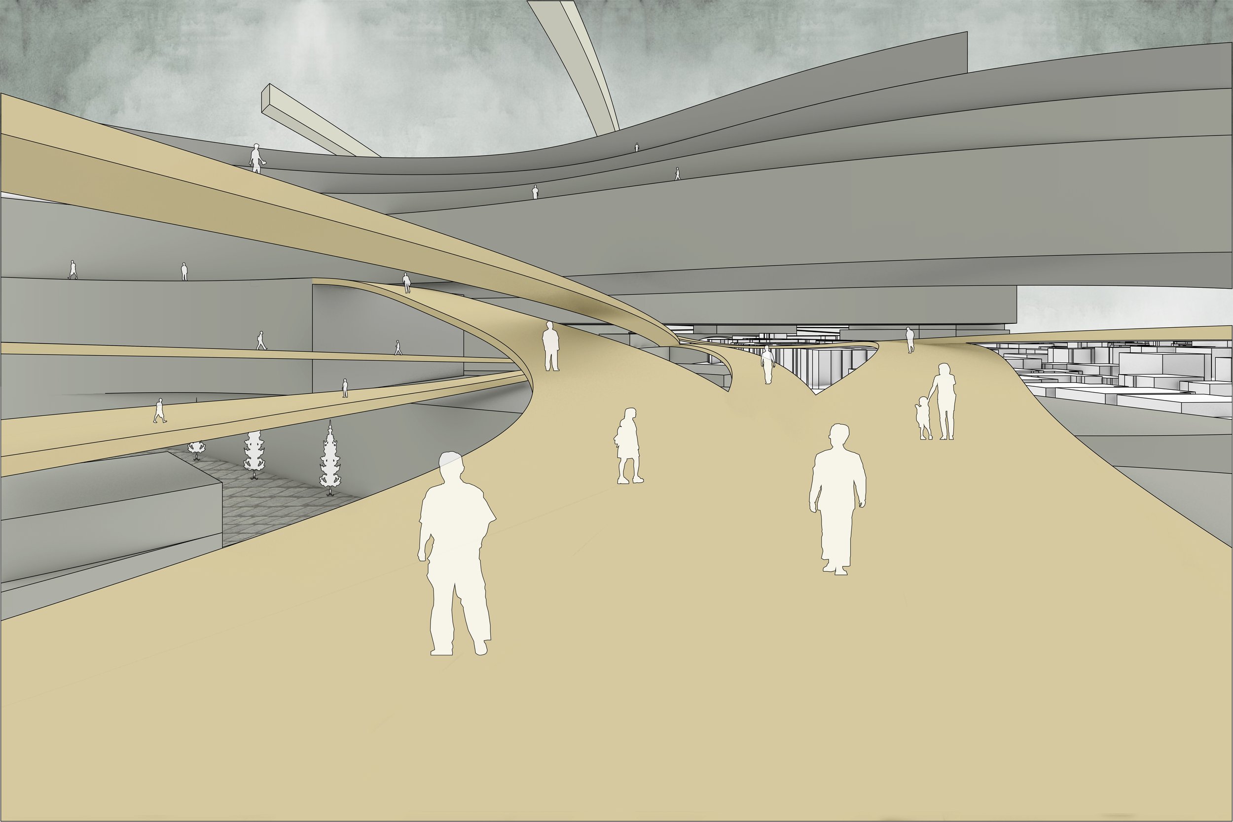
The primary objective is to establish a network of pedestrian ramps that not only grant convenient access to various structures but also transform into an integral part of the buildings. This building-bridge integration blurs the lines between where pedestrian ramps conclude and the actual structures commence, ensuring a seamless blend. Furthermore, the buildings serve as structural supports for these bridges, fostering a symbiotic relationship between form and function. The ultimate vision is to create dynamic and vibrant pedestrian paths that extend beyond mere utility, offering an engaging and entertaining experience for those utilizing the transport infrastructure. In doing so, the project aims to promote pedestrian transportation, reduce reliance on automobiles, and cultivate an intriguing and enjoyable environment for its inhabitants.
PROGRAM DIAGRAM


TRANSPORTATION DIAGRAM
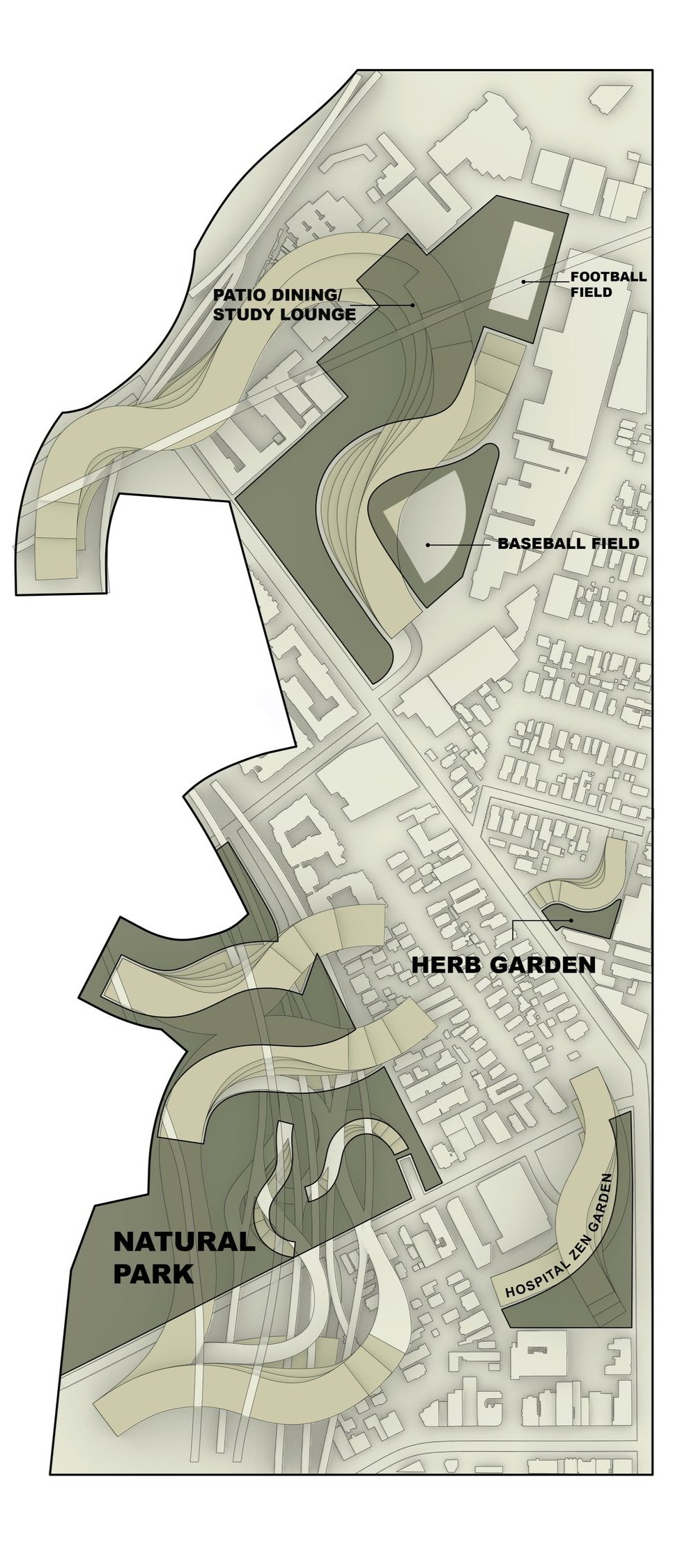
OPEN SPACE DIAGRAM
The open space diagram serves to further illustrate the “in-between spaces” or in other words, the spaces that are created as a result of the new construction. Often overlooked, these spaces presented an opportunity for me to capitalize on unused areas and transform them into green oases.
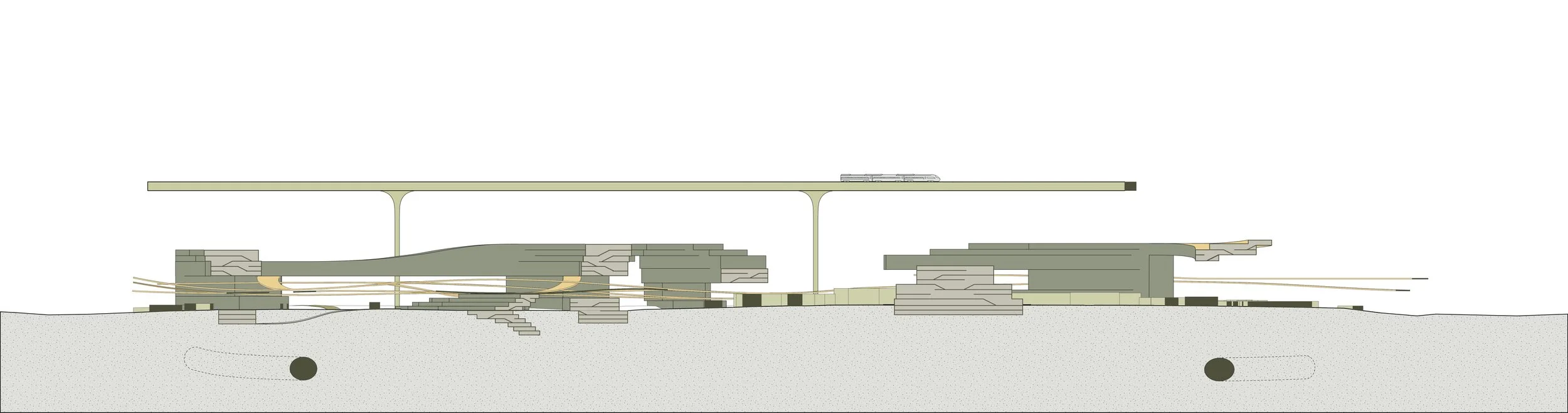
LONG SECTION
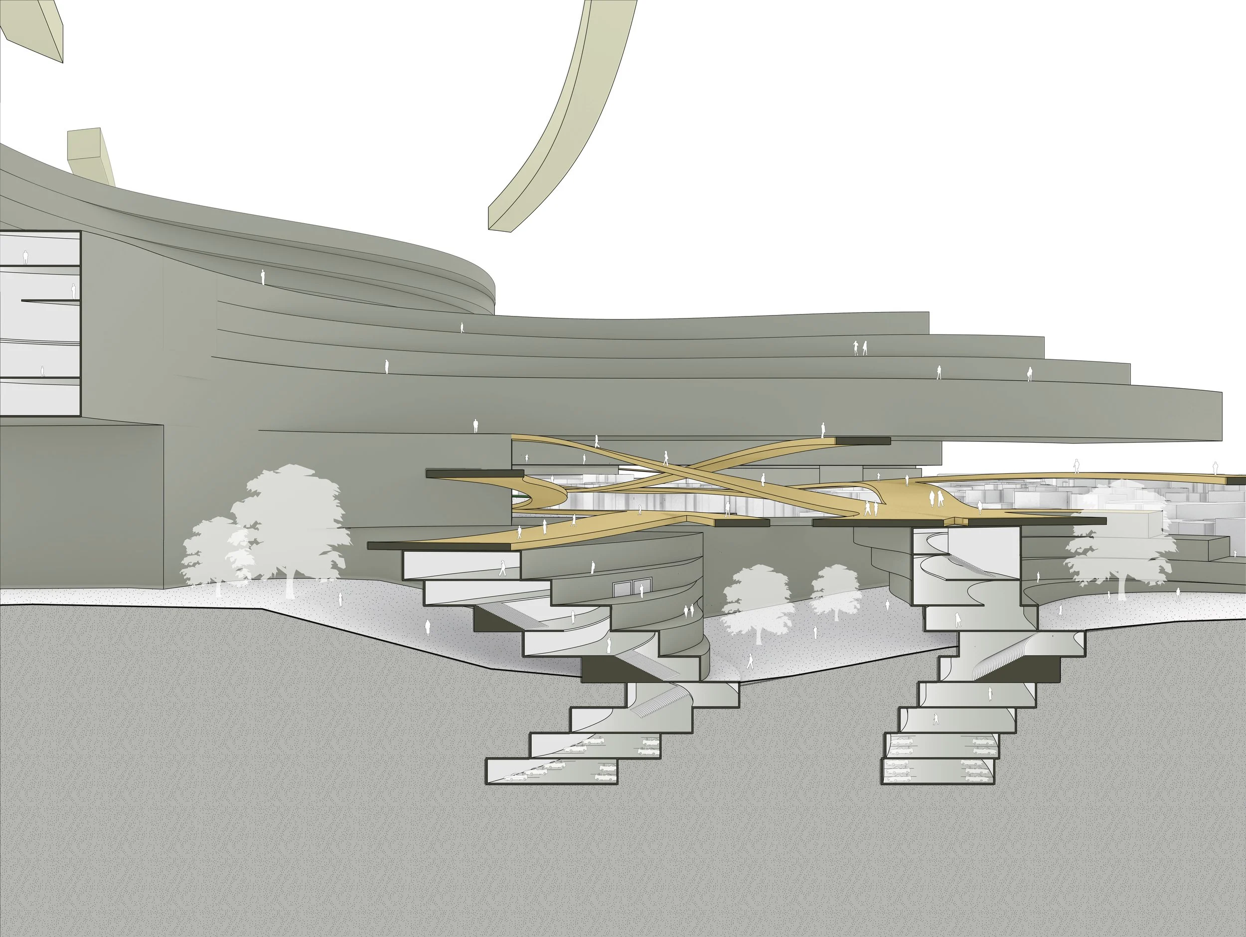
DETAILED SECTION
ISOMETRIC SECTION
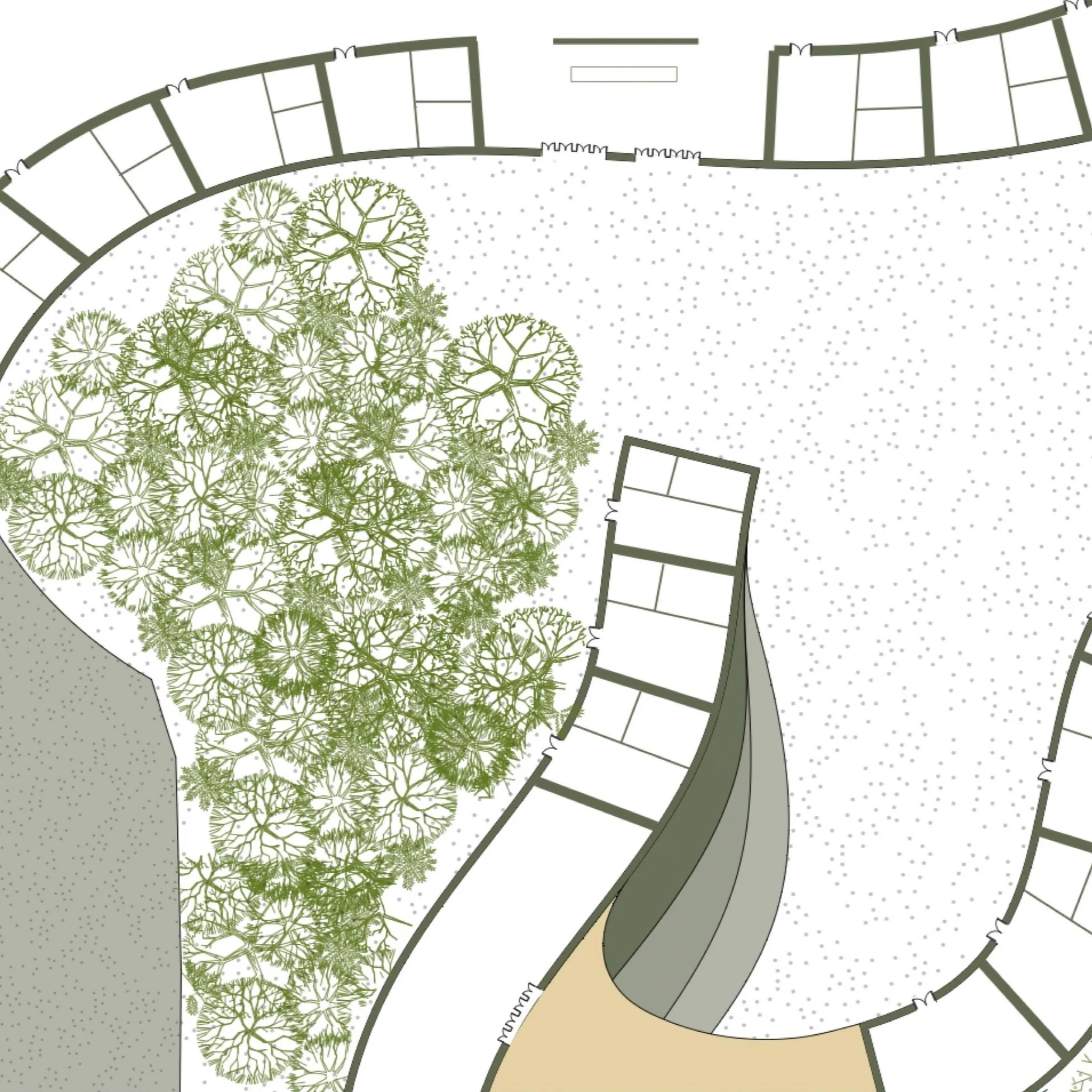
DETAILED GROUND FLOORPLAN
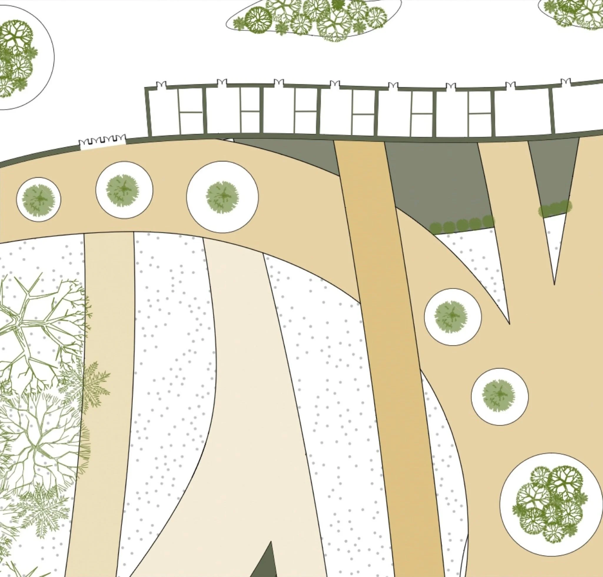
DETAILED UPPER FLOORPLAN
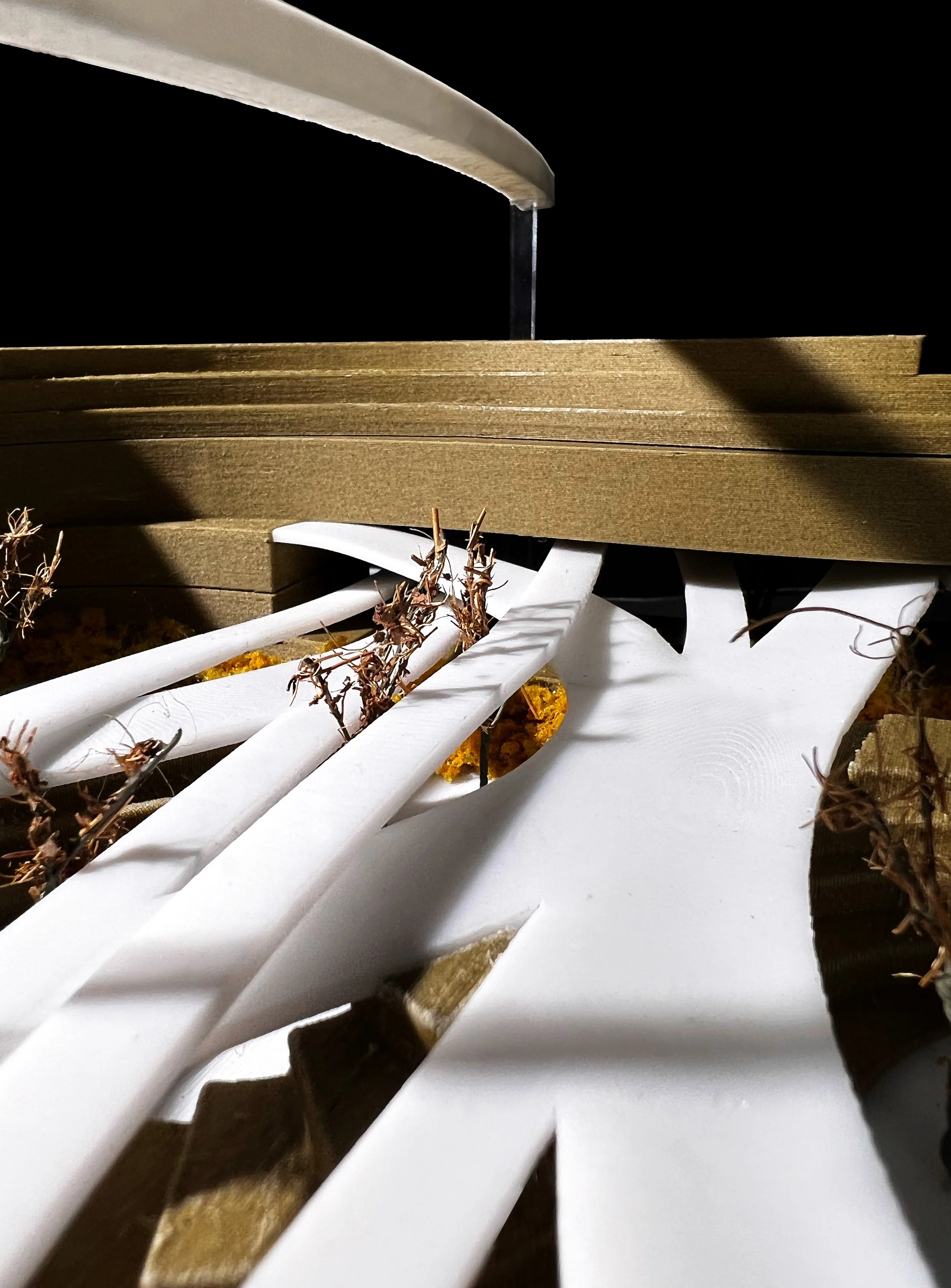
MODEL PICTURES


POTENTIAL CONSTRUCTION
This interactive architectural model showcases the application of my design system in response to population growth. The ribbon-like building sections are designed for effortless replication and stacking, allowing adaptation to various existing or intervening conditions. Users have the flexibility to physically stack each level in their preferred arrangement, leading to diverse design possibilities tailored to meet the needs of the occupants utilizing this space.